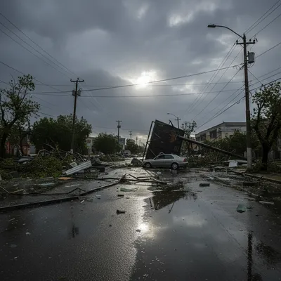
Aucklanders and residents in nearby regions are being told to brace for another bout of wild weather, with a heavy rain watch issued for Sunday night and Monday morning just days after a significant storm battered the upper North Island.
MetService has issued a yellow heavy rain watch for Auckland, the Waikato, Taupō and Taumaranui. The weather system, sweeping in from the north, is expected to bring a period of intense rain and strong winds to exposed areas. Forecasters are predicting downpours could reach rates of 35 mm/h in localised areas from 1am on Monday, accompanied by possible thunderstorms.
While the front is expected to be fast-moving, described by MetService as "wet and windy weather whizzing through," the primary concern for authorities is the already saturated ground, particularly in the Far North. Officials have warned that even areas outside the official watch zone could experience "brief bursts of very heavy rain and strong wind gusts".
Residents across the upper North Island are being advised to use the remaining daylight hours to prepare their properties. "Now's the time to clear the drains and gutters and secure anything that could fly away or fall over," MetService advised.
Far North on high alert
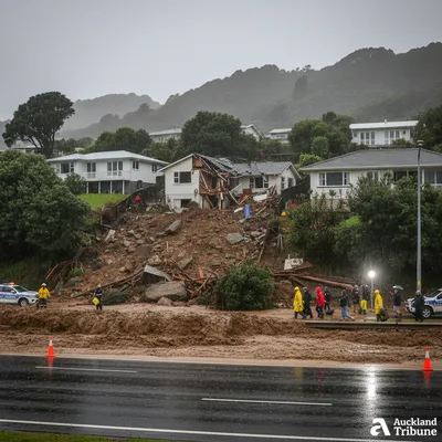
The Far North is facing a precarious situation, with the ground already sodden after severe weather caused widespread disruption last week. The Far North and Whangārei districts remain in a state of emergency, and the latest forecast has put residents and civil defence authorities on high alert.
The Far North District Council (FNDC) has warned that the ground's saturation makes the area exceptionally vulnerable to new slips and further flooding. The impact of the previous storm was severe, causing significant damage to infrastructure, including the road surface of the Whakapara Bridge on State Highway 1 north of Whangārei, which highlighted the fragility of the transport network.
With more rain imminent, the council is urging extreme caution. Residents are strongly advised to stay away from existing landslides and slips, which could become unstable. They are also urged to avoid waterways and steep slopes, as flash flooding and further land movement are significant risks.

The FNDC has its emergency helpline open for residents to report weather-related problems on 0800 920 029. The council noted the line operates around the clock and that if callers cannot get through, they should leave a message to receive a call back. Any immediate threats to life or property should be reported to 111.
A region just beginning to recover
The incoming weather system threatens to complicate a recovery effort that is only just beginning. While floodwaters have been receding in towns like Kāeo, allowing State Highway 10 to reopen and restore access to Kaitāia, the cleanup is far from over. Damaged roads and inundated properties are a common sight across the region.
The relentless nature of these weather events is taking a significant toll on communities. For some, like Ōakura Bay couple Linda and Roger Kelsall, the latest storm brought a devastating sense of déjà vu, flooding their home for the second time in just two months while repairs from the January storm were still underway.
These repeated events are part of a wider pattern of extreme weather that has put a spotlight on climate change resilience in Northland. A 2022 government report identified several vulnerable communities in the region that could face managed retreat in the coming years, prompting visits from government ministers to assess the long-term strategy for adaptation.
What it means for Auckland
For Auckland, the yellow watch serves as a notice to be aware of potentially disruptive weather. While not as severe as an orange or red warning, the predicted rainfall intensity could still cause surface flooding and hazardous driving conditions, especially during the Monday morning commute. Information on road conditions and public transport can be monitored through the Auckland Transport app and Waka Kotahi NZTA.
Residents are encouraged to take preventative measures. This includes securing loose items on balconies and in backyards, a particular concern for those in apartments who may need to coordinate with neighbours or a body corporate. Clearing gutters and stormwater drains can also play a crucial role in preventing localised flooding around properties. For official updates on the weather, people should consult the MetService website.
Authorities are hoping the weather system passes as quickly as forecast. However, the key message for the entire upper North Island is one of vigilance, as the impact of this new front will be magnified by the damage and saturation left behind by the last one. All eyes will be on the skies through Sunday night and into Monday morning.